This group design project was a part of the ‘Visualization and Geospatial Analysis’ class in the Department of Urban Planning and Policy. This project uses one entrance to the Humboldt Park in Chicago as a case study to improve pedestrian and cycling access that could later be expanded to other areas and finally mitigate the prolific health and safety concerns of the neighborhood.
Located in the center of the Humboldt Park community area, Humboldt Park, named after the famous German scientist and geographer Alexander Von Humboldt and created in the 1890s, is a large (about 200 acres) green area with historical buildings, water bodies, sports grounds, and natural areas.
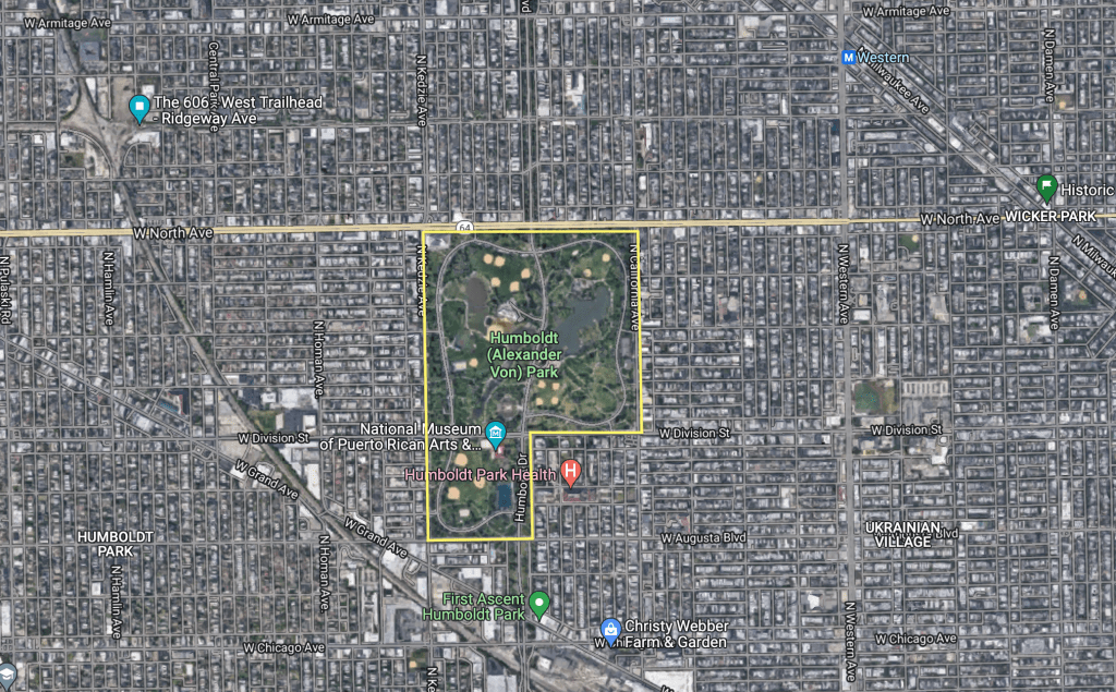
Image source: Google Maps
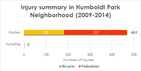
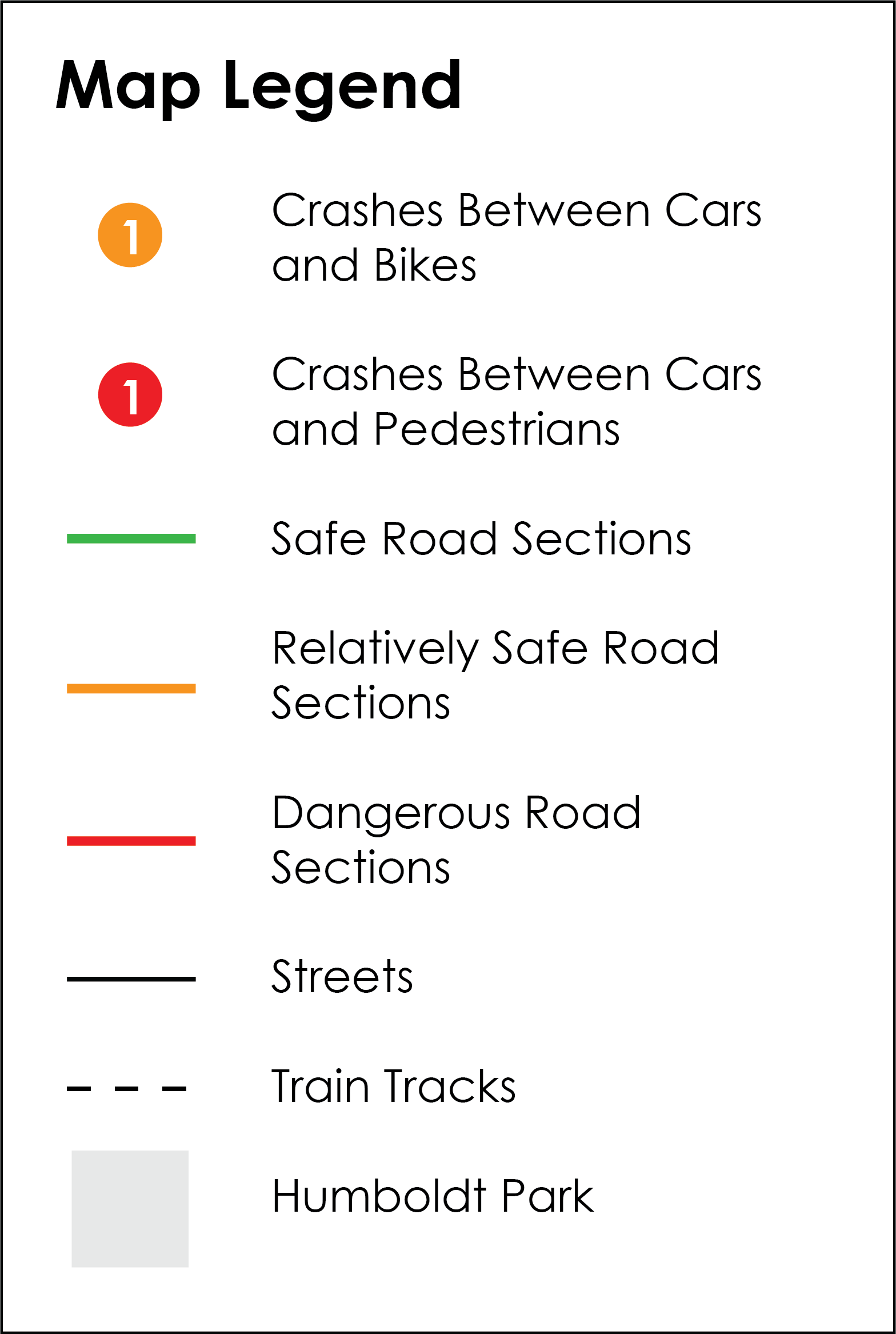
As the data shows, the safety of pedestrians and cyclists is a primary concern around Humboldt Park. Therefore, addressing this is a priority for the Humboldt Park wellness and pedestrianization initiatives.
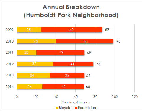
On the left – annual breakdown
On the top – injury summary
Most crashes have cars involved and happen through the busiest transportation corridors around the park: W North Ave, N California Ave, and W Division St.
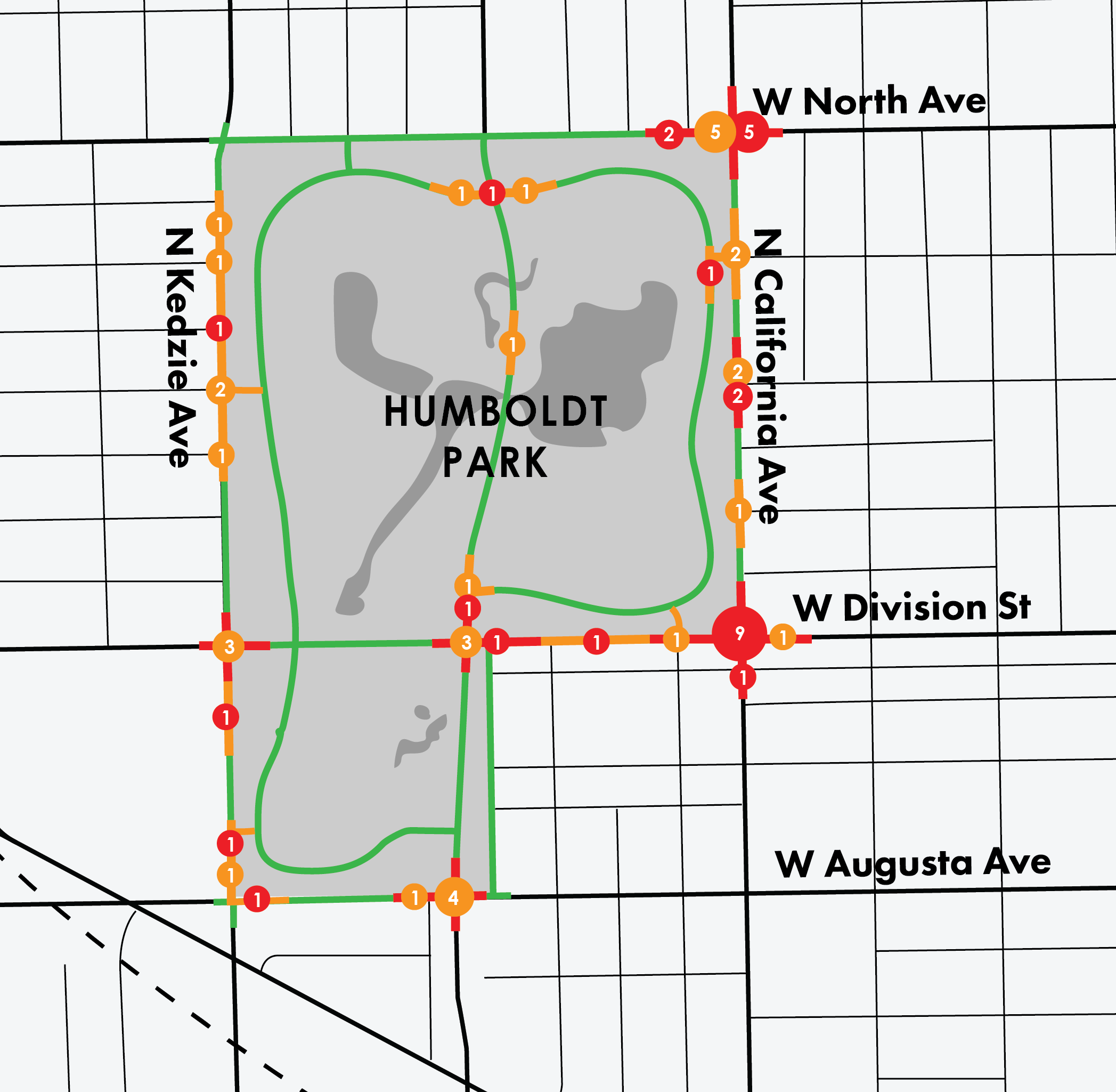
Views of the safety improvements both in and around the park and the built features to prohibit cars from entering Humboldt Park will improve pedestrian and cyclist safety. We use an entrance from N California Avenue (Intersection of N California Avenue and W Le Moyne Street) as a case to show how proposed safety measures could be implemented.
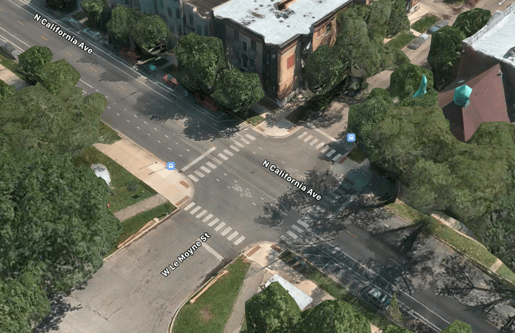
Source: Google Maps
The main idea of this design project was to minimize car access through this entrance and significantly increase pedestrian and bicycle access. To accomplish that, our design project involves several measures, including a crossroad street lighting program, converting a road segment into a pedestrian zone, and reducing the number of car lines in favor of bike lanes and safety lines with grass.
First, we propose closing a part of W Le Moyne Street that goes into the park to provide better and safer access for pedestrians and bicyclists. This will transform an intersection from a four-way intersection to a three-way intersection (T-junction) and reduce overall speed in this segment. Second, two isolated bike lanes are proposed to be created on the street side – with a physical barrier between automobiles and bikes. Currently, there are bike lanes; however, the safety is low since they are not isolated and are located between parking and driving lines (the worst way of creating a bike lane). Finally, the separator (with grass and small bushes) is proposed to be created in the middle of the road to reduce speed and increase the safety of pedestrians while crossing the street.
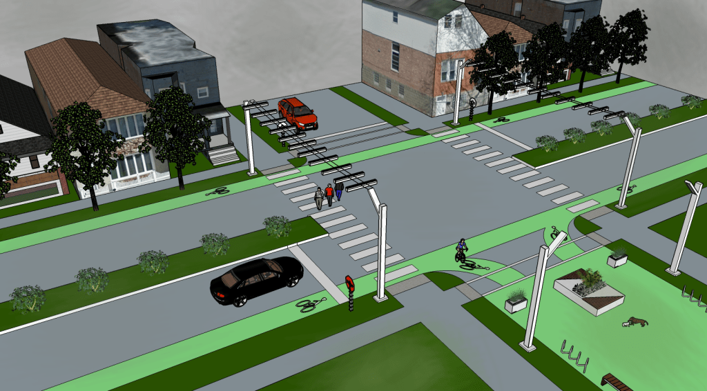
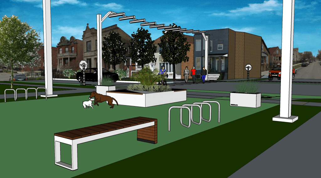
for pedestrians, bicycles, and small vendors (green surface)
The pedestrian zone created on the former segment of W Le Moyne Street has bike racks (with optional Divvy bike stations and e-scooter designated parking areas) as well as street furniture. It is allowed for cyclists to enter the park directly from the bike lanes on the N California Avenue.
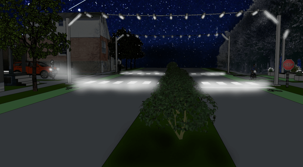
Night safety is one of the crucial components of the proposed design project. New street lighting will provide safe passage to the park at all hours by creating a bright pedestrian corridor. This will allow drivers to see pedestrians from a high distance, reduce braking distance, and be prepared to stop and wait until the crossroad is empty. To follow principles of energy efficiency, LED lighting will be installed, and it is proposed to include an innovative solar street lighting system that can aggregate solar power during the daytime and minimize energy use from a grid during nighttime.
We believe that the proposed solutions will allow increasing the safety of the park and surroundings and decrease the number of crashes and following injuries for the most vulnerable actors of the traffic: pedestrians and bicyclists.
All sketches, graphs, and maps are made by Anton Rozhkov in 2017.
Tools used: [Sketch Up] [Adobe Photoshop] [Adobe Illustrator]
